Above and below are two illustrations showing the narrow packhorse
bridge which used to span the River Derwent close to Derwent
Hall. Firth described the stone bridge as "a
beautiful two arched bridge ... flagged with stones like
a pavement and much too narrow to admit the passage of any
vehicle"[1].
He observed that the triangular recesses allowed those travelling
on foot to step into them to avoid the packhorses. In the
centre of the south parapet was the base of a cross or a
crucifix[2] and
the bridge was believed to have been built in the seventeenth
century[3],
although both Firth[1] and
Cox[2] described it as ancient.
 |
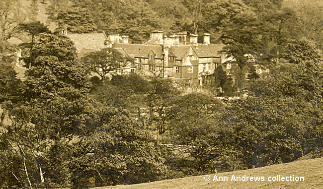
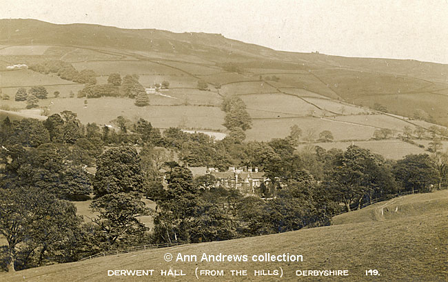
Derwent Hall (shown below), "a fine and picturesque
old gable building... with several later additions, all in good taste, though too much smothered in ivy", was built in 1672 by
Henry Balguy[2]. It had been owned by the Newdigates until it was bought by the Duke of Norfolk.
The property was said to have lovely gardens[1]. Bulmer's 1895 Directory described the scenery as
"varied and picturesque, and in many parts wild and romantic" with the sides of the dale "embellished with fine specimens of
sycamore, fir, pine, mountain ash and lady birch"[4].
The Derwent Valley Water Board purchased the house and its land from Viscount Fitzalan of Derwent in 1927[3]
and it was used as a Youth Hostel Association holiday centre from 1932 until 1943.

Derwent Hall, seen from the hillside above the house.
Enlargement of the pre-1916 postcard at lower down the page.
The 1911 census tells us that the Hall had 42 rooms, but only the butler John Dunn, his wife, daughter and two female housekeepers
were in residence on census day[5].
In 1934 the Derwent Valley Water Board met at Nottingham to discuss constructing the great Ladybower Dam. Before
the First World War it had been estimated that the project would cost £750,000 but by 1934 the cost was
believed to be half as much again. It was also estimated that the Dam would take 10 years to construct[6].
A year later "The Times" reported that the Water Board had decided to complete the programme of works
they had begun in 1899, with the third instalment which included the construction of a third dam at Ladybower and
construction began[7]. Derwent Hall's fate was sealed. The historic Hall,
together with the villages of Ashopton and Derwent, would disappear beneath the water.
Members of Derby Photographic Society visited the Hall to take pictures for the County photographic survey in 1939.
The photographs were considered to be of considerable importance as, within a few days of the Society members visit,
work was to begin on felling trees and dismantling buildings to make way for the new giant reservoir[8].
King George VI and his wife, Queen Elizabeth, visited Bamford to open the third and final phase of the Ladybower
scheme which would supply water to Derby, Nottingham and Sheffield in 1945. When it was completely filled it would
hold 6,300,000,000 gallons of water. The new dam had taken the estimated 10 years to build, with work on the project
continuing throughout the war despite problems. The villages of Ashopton and Derwent were submerged by 1945, with
only the tower of the church built in 1867 showing where Derwent village had been[3].
The fine oak panelling and some other things were saved from the Hall[3]. Following
a public appeal before the war to save the packhorse bridge it was dismantled, the stones were numbered
and then they were stored. In 1959 the bridge, by then scheduled as an ancient monument, was rebuilt to span the
Derbyshire - Yorkshire boundary at Slippery Stones; the work was estimated to have cost about £3,000[9].

Derwent Hall and surrounding hills, early 20th century.
The parish of Derwent Woodlands was described as "extensive and thinly populated ... embracing an area of about 25,000 acres"
in 1895[5].
|