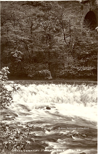
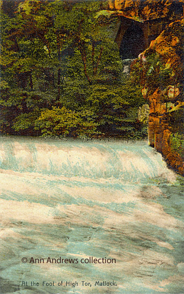
The weir across the River Derwent, shown here, was just below where the former Manchester, Buxton, Matlock & Midlands Railway
Company railway line was built just below High Tor. This was the point where the line emerged from one tunnel, providing a
glimpse of Matlock Dale for the train passengers, before entering a second tunnel. As the Illustrated London News commented in
1849 "You next pass through the High Tor Tunnel, dry and comfortable, and the gloom much dissipated by an opening
in the centre, wherein you enjoy daylight for a second or two, and a pretty view of the road and the river"[1].
Once the trains got faster, if you didn't know where to look, one blink and you would have missed it.
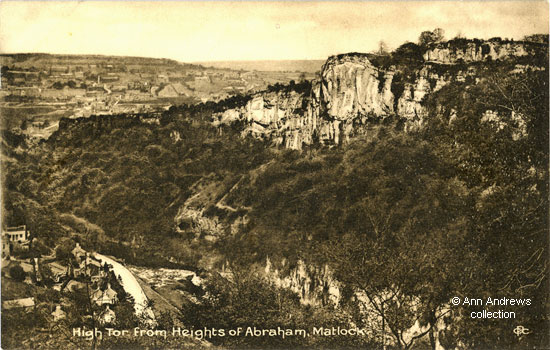
This top image looks down into the valley from Long Tor. We are able to see over the top of High Tor to the development on Matlock
Bank. Whilst the postcard was not used, the picture dates from 1892-5 as you can see chimney of the tram depôt but the Victoria
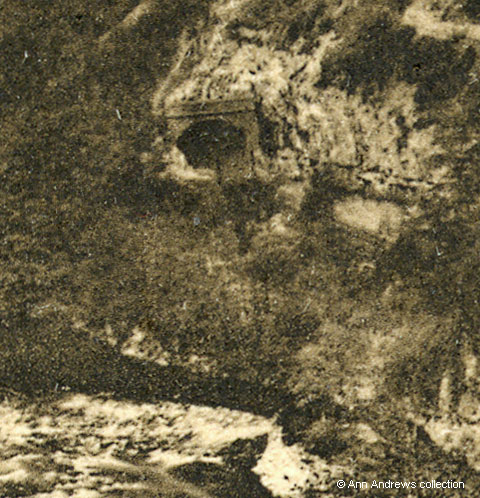
Hall had not been built. Below is an enlargement showing the original gap between the tunnels.
|
Railway tunnel and weir, enlarged from the top image. It shows the south portal
of the original northern tunnel; this section was later protected by the new
58-yard tunnel. Although the entrance to the goit is not easy to see here,
other images suggest it was opened and closed by vertical
wooden boards (needles) which could be lifted out when required[2]. |
Whilst the railway tunnel was being blasted through in the mid to late 1840s Messrs. Wheatcroft, Buckley and Clayton, who were
the contractors for the work, erected a replacement bridge below High Tor of about 60 feet in length; it was their only means
of getting themselves, the dynamite and anything else they required across the river. Unfortunately, like several other wooden bridges
built over the years, this was partly destroyed by a flood during heavy rain in December 1848. It was left swinging above what
was described as "a powerful and foaming torrent", held only by slender "gye" chains. It caused quite a stir
locally and the half destroyed bridge was viewed by several hundred people[3].
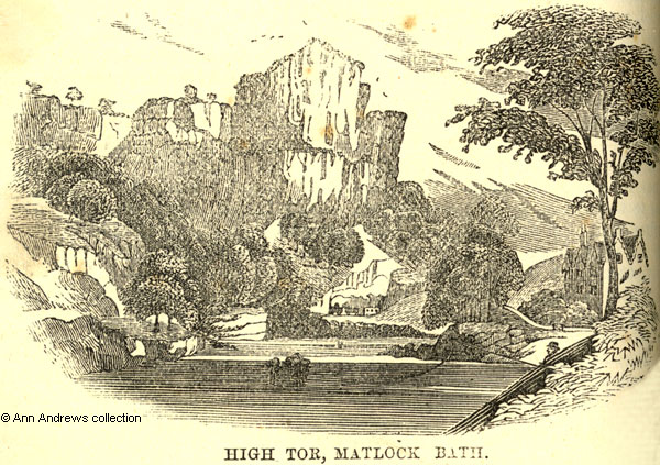 |
Engraving, probably 1858-70. Note the fisherman on the right,
tucked in behind the wall.
This is more artists's impression rather than accurate drawing
but it nevertheless provides an early
view of the tunnel. |
At the end of it all, on 10 May 1849, Mr. Wheatcroft used the auctioneers
Cotes of Wirksworth to sell off "valuable railway plant, comprising
powerful crabs, ropes, chains, pulleys, waggons, trollies [sic],
barrows, picks, augars, hammers, crow bars, blacksmith's plant,
including two full sets of tools; a very powerful lathe with every
variety of boring and drilling apparatus, turning tools, a high
pressure steam engine, a large quantity of sawn and round timber
... theodolite" and even the bridge over the River Derwent.
This all took place opposite High Tor[4].
 |
| About 1906 |
In the penultimate postcard (above), taken by John William Jamson of the Doncaster Rotophoto Co., we can see that changes have been
made to the tunnel entrance. The picture shows the south portal of the new, middle, tunnel (High Tor Tunnel No.1A) built between
the original north (High Tor Tunnel No.2) and south (High Tor Tunnel No.1) tunnels. The brickwork casing of the tunnel looks
reasonably new and might have been about ten years old when it was photographed. It was slowly accumulating a covering of overgrowth,
but this was in the very early stages[2].
 |
Probably of a slightly later date than image 4. We can see the
goit on the right. There appear to be two metal rods, and a wall
of finely cut stone blocks, which suggest a mechanism
was in place for raising the boards when needed. Next to where
the river came down the weir is a traditionally built dry stone
wall. |
Unlike the weir near Masson Mill further downstream, which is
curved, the Matlock Dale weir opposite Craven Villa and Riversdale
was built in a straight line which bisected the river diagonally.
The angle would have forced some of the water down the side stream
or goit that had been created, which Bryan said the locals used
to call a "ghaut"[5].
The goit created a long, thin island parallel to the Derwent which
the colour works was built on. The diverted water drove the wheel
on the colour works site. It drove a pump, via rods, down the passage
under High Tor behind the works. That helped to clear water
from under the Side Mine workings, which were mainly to the south
of that site, by the old road up to Starkholmes, above the gas
works. The antiquarian David Palmer Pearson, who lived almost opposite
at Heathbank and then Hilderstone,
said that this was erected by Mr Boothman between 1820 and 1830[6].
In the summer of 1921 the Council considered a proposal submitted
by Mr. Pearson to generate electricity from the power of the river
Derwent. It didn't get off the ground as George Henry Key, the
colour grinding works manager, pointed out that when all the machinery
at the colour works was in use the goyt took all the water from
the river, so completely drained the bed of the stream below the
High Tor weir[7].
This weir has now been removed[8] and the
tunnel has been covered over, so the tunnel of today is unbroken as the railway line passes under the Tor.
|
References:
[1] "Illustrated
London News", 24 Nov 1849.
[2] Information from Colin Goodwyn, who
has been very generous with his time and help.
[3] "Derby
Mercury", 13 December 1848 and "Derbyshire
Courier", 16 December 1848. The railway bridge replaced
a bridge owned by Michael Cardin, intended to be permanent
but washed away by a flood only a few weeks before.
[4] "Derby Mercury",
9 May 1849. High Tor Tunnels, Matlock. Important Sale of a valuable
Railway Plant.
[5] Bryan, Benjamin (1903) "History
of Matlock - Matlock, Manor and Parish" London
by Bemrose & Sons, Limited.
[6] Description of the wheel from Colin
Goodwyn, who has researched articles written by David Palmer
Pearson (1858-1932).
[7] "Derbyshire Courier", 27
August 1921.
[8] According to Peter Hare, who used
to work at the Colour Company a little further downstream, the
weir was removed in the 1970s.
|


