|
Images Index> Matlock, 20th and 21stC Images> This page |
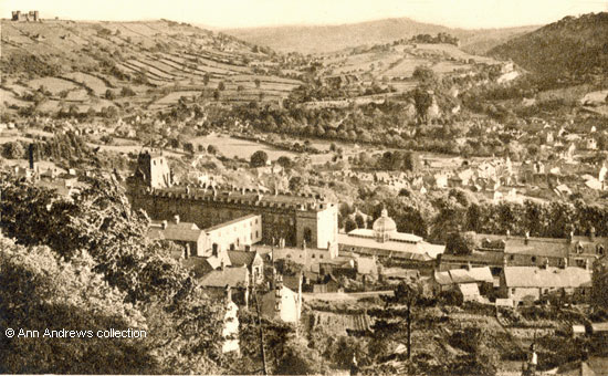
| Matlock: Castle View, Looking Towards Riber & Starkholmes |
| Matlock : Twentieth Century Photographs, Postcards, Engravings & Etchings |
|
|||
At the Winter Gardens end of the former Smedley's Hydro is one of the two covered corridors/walkways across Smedley Street, connecting the older buildings on the southern side of Smedley Street with the post-1900 ones on the opposite side of the road. The first of these double decked bridges, not shown on this image, connects to buildings on the street edge close to what is now County Hall's main entrance. It was opened on 7 September 1901 when a new annexe was partially launched. The annexe was to consist of 45 bedrooms and seven shops. The new block was parallel with the older buildings, and a "connection between the two buildings ... reached from the second and third landings of the hydro". Visitors were able to access their rooms easily by using the hydro's lift and then crossing over. The entire project had been designed by the hydro's resident architect, William Doxey[3]. Further bedrooms were added in 1906 and 1910. Here we can see the second bridge which is longer than the first one but has considerably less clearance over Smedley Street. It provides access from the west wing of the main building to the northern block. Unlike the 1901 bridge, it is supported by stone walls or pillars on either side of Smedley Street and the second bridge continues further before joining the hydro buildings. Indeed, the northern side seems to have been added as an afterthought rather than as an integral part of the hydro's design. It was added about 1930.  Detail from an aerial photo by Frith, about 1955. The arrows point to the bridges.
|
|||
|
1. "Matlock, Castle View". Photochrom Co. Ltd., Graphic Studios, Tunbridge Wells, Kent, Publishers to the World. No. V969. Not used. Another of these cards was posted in 1950. Postcard in the collection of and provided by and © Ann Andrews. 2. Detail from "Smedley's Hydro, ca 1955" published by Francis Frith. Also Ann Andrews collection. Researched, written by and © Ann Andrews. Intended for personal use only. |
|||
|
[1] "Derbyshire Times", 28
May 1932. |


