|
Images Index> Matlock, 20th and 21stC Images> This page |
| Matlock: The Wishing Stone |
| Matlock: Twentieth Century Photographs, Postcards, Engravings & Etchings |
|
|
||||||||||||||
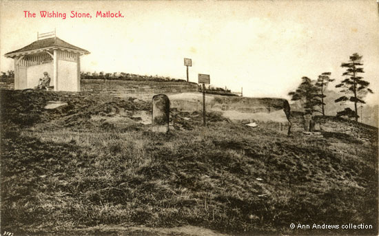
It lies close to Asker Lane and now falls within the Lumsdale conservation area. On the 1879 map it is marked as an old quarry, though footpaths led to it and round it at that time[1a], which would have been used by the miners and those working in Lumsdale over the centuries. The stone is first marked on the 1899 OS map, with access from the corner of Asker Lane, Lumsdale and to Matlock via Hurst Cottages. The surrounding land was then clear of trees[2a]. We can see a squeeze stile beyond the stone, in the dry-stone wall on the right, something humans could get through but not livestock.
"By a narrow passage opposite the Congregational Church in Chesterfield Road a path is entered leading across several fields. At the sixth field turn to the left along a grassy path to Hurst Farm. Round this farm to the right by some cottages, and through a field to the mass of rock known as the Wishing Stone. The views from this height will tempt the visitor to linger. The return can be made by a path on the right, down the hill from the Wishing Stone to Lumsdale first mill ; and by keeping to the road, to a stile at the lower end of the Dale, which leads across the fields to Matlock Bank"[1]. The stone was still privately owned in 1926, although Councillors had expressed an interest in buying it twenty eight years earlier when it was known locally as the Broad Stone. In 1898 Council members had suggested developing the area into walks. The stone then belonged to a Mr. Berresford, who owned Hurst Farm[2] although Benjamin Bryan[3], writing in 1903, believed it belonged to Mr. Garton as he stated that Mr. Garton did not object to the "wishers". Bryan also said that it was "strangers coming to the place, by whom it is largely visited", who called thise rock "The Wishing Stone".
It is noticeable how open the landscape on the right was in both the image above and the one below.
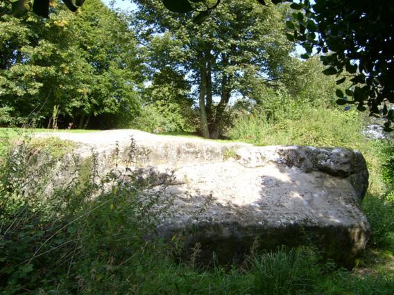
 The Wishing Stone, 2004
|
|||||||||||||||
|
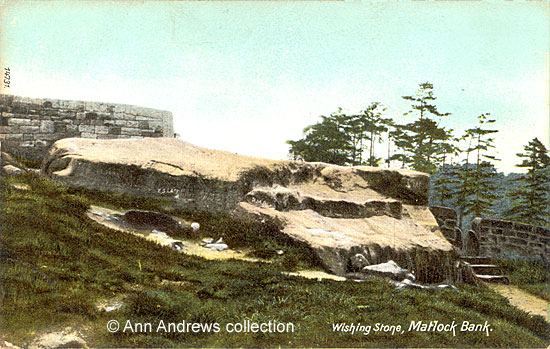
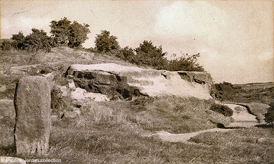
Images: 1. Top image: "The Wishing Stone, Matlock". The Bon Marche series, No.3513. Printed in Saxony. Not posted. Undated, but it is thought to have been taken in the first decade of the twentieth century. In the collection of, provided by and © Ann Andrews. 2. "Wishing Stone, Matlock Bank". The Wrench Series, No.14731. Printed in Saxony. Unused, Stamp Box records Inland ½d. Stamp. Foreign 1d. 3. "The Wishing Stone, Matlock" published by Rhodes Shops, No.4909. Photo., A. J. Roberts. posted on 25 Aug 1948. In the collection of, provided by and © Pauline Jordan. F. R. Rhodes ran the East Smedley St. Post Office in 1941. 4. "Wishing Stone, Matlock". One of Valentine's Picture Panels of Matlock & District, printed in Great Britain. No.204461? Real Photograph (1 of 12). First published in 1928. © Ann Andrews collection 6. "The Wishing Stone, Matlock". No publisher and not used. © Ray Ash collection. 7. 2004 photograph © Private Contributor. Researched, written by and © Ann Andrews. Intended for personal use only. |
|||||||||||||||
|
[1a] Ordnance Survey map: Derbyshire Sheet XXIX.SE. Surveyed 1879. Published 1884. [2a] Ordnance Survey map: Derbyshire Sheet XXIX.SE. Revised 1897-18989. Published 1899. [1] Ward Lock & Co's "Matlock, Dovedale, Bakewell and South Derbyshire", Illustrated Guide Books of England and Wales (1926-7). The guide book omitted to say that there would one or two fairly steep slopes along the route! Most of the paths described are still on today's maps but the Congregational Church was demolished in 1969 and Hurst Farm has been a housing estate for a long time. [2] "Derbyshire Times and Chesterfield Herald", 8 Oct 1898. [3] Bryan, Benjamin (1903) "History of Matlock - Matlock, Manor and Parish" London by Bemrose & Sons, Limited. [4] "Derbyshire Times", 29 Nov 1902. A Plea for a Beautiful Matlock. [5] "Derby Daily Telegraph", 8 May 1901. [6] "Derby Daily Telegraph", 20 Feb 1934. Announcement at a meeting of the Matlocks Urban Council the night before. [7] "Derby Daily Telegraph",
18 June 1935. |


 There is another postcard of the Wishing Stone. See