This picture of the signal box, which dates from 1969, is
very dramatic. This was the post Beeching era and the axe
had already fallen on the line extending northwards from Matlock
to Manchester. The signalman is just about discernable behind
the glass windows of his box; the steps he would have to climb
up and down each day (on the left) were extremely steep. Presumably
he owned the parked car with the registration plate of KAT 720.
The track was possibly being taken up as he worked[1].
Immediately behind the signal box is the goods shed that is also
shown in the first of the series of photographs below. As you can
see, the lines passed either side of the signal box as well as
a short track leading into the shed. The shed doors are also featured
in the pictures below (photos 2 and 3). These photos are included
to show some of the more recent history as the Cawdor Quarry and
Station areas were developed.

1. Goods shed, 2004, showing years of neglect.

2 and 3. The images above and below are of the
building's interior in 2004.
The roof had gone and the floor boards were rotten.

4. The walk from Matlock station to what was then Peak Rail's Matlock
Riverside station was originally about 500 yards.
It was a long trek ... some commented that it needed another train
to get there!!

5. Approaching the platform at Matlock
Riverside in 2004.
The web mistress has no idea what the stone structure on the right
was. Any ideas would be welcomed.

6. The platform in 2004.
Fortunately, the second
platform at Matlock station has been refurbished, according to Peak
Rail's website (the link will open in a new tab or window),
and Matlock Riverside has gone.

7 and 8. Just to complete the picture for the early days of Peak
Rail's presence in Matlock.
These signs seemed a trifle optimistic for those on foot in 2004.
It is amazing how far Peak Rail have come since then.


To complete the station re-development story we must include
the 2008 footbridge:
 |
|
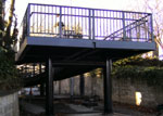
In 2008 a large metal footbridge linking
Matlock's Railway Station and the new Sainsbury's store was
installed on the station's forecourt. It goes over the top
of the station building and connects to a path on the far
side of the track that leads directly to the store. It was
was probably one of the most ill-judged decisions from the
conservationist viewpoint that the council of the day made,
despite the fact that it has undoubtedly enabled residents
of Snitterton Road easier access to the town. It resulted
in the launch of the Matlock Footbridge Campaign, with local
people objecting to both the scale and design.
We have our own pictures from that time, kindly provided
by a resident, showing what people were so upset about.
Each image will open in a new tab or window.
- Station
Approach 1 - the ground work was not quite completed
- Station
Approach 2 - " " " "
- Station
Approach - View of the Bridge
- Bridge
and Railway Station 1
- Bridge
and Railway Station 2
- Former
Station Master's House. The bridge had been constructed
very close to the Grade II listed building.
- Station
Bridge 1 - on the bridge.
- Station
Bridge 2 - what a view the station master's house
now has from its front windows.
- Station
Bridge 3
|
Those with railway ancestors might like to see:
 Matlock & Matlock
Bath Lists: The Twentieth Century: Matlock Station Staff, 1911 - 1966, A -
J Matlock & Matlock
Bath Lists: The Twentieth Century: Matlock Station Staff, 1911 - 1966, A -
J
 Matlock & Matlock
Bath Lists: The Twentieth Century: Matlock Station Staff,
1911 - 1966, K - Y Matlock & Matlock
Bath Lists: The Twentieth Century: Matlock Station Staff,
1911 - 1966, K - Y
|


