|
Images Index> 20th & 21st Century, Matlock> This page |
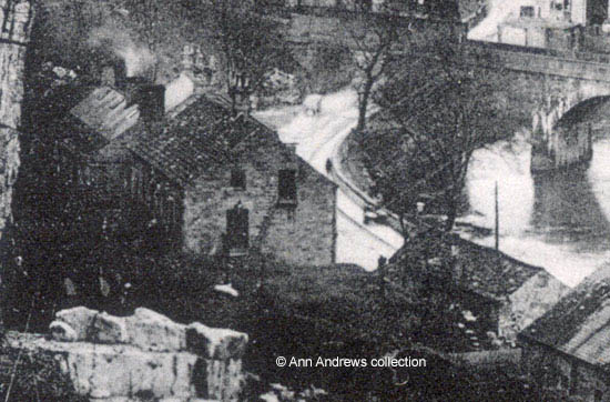
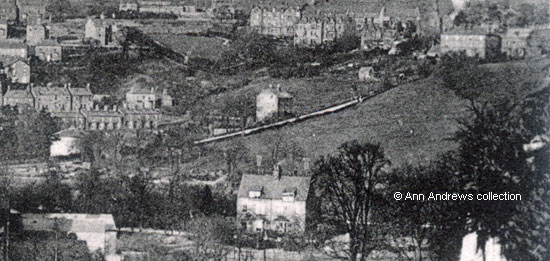
| Matlock Bank and Bridge - from near the Quarry, 1907 |
| Matlock : Twentieth Century Photographs, Postcards, Engravings & Etchings |
|
|||
On the far right of the picture is a large field bordering Steep Turnpike which ran almost the full length of the road (enlarged below). This was numbered 897 on the 1848 tithe map and its owner and occupier was shown to be George Nuttall (Dale Hill and Hovel, pasture). There was another piece of land surrounded by the field, No.898 on the tithe map and today known as Harley House, which also belonged to George Nuttall. The occupier was John Else (House, courts and garden).[1] Mr. Nuttall also owned The Firs - now the library - which he had inherited from his mother and a considerable amount of other property in the town and elsewhere. Following his death in 1856 these two parcels of land were listed in his Will, alongside several other fields. He had left them to his housekeeper Catherine Marsden, who was his cousin, and after her death to John Nuttall of London[2]. They crop up again in a detailed purchase document of 1876 when Lindsey Hodgkinson of Matlock was buying some of the Copyhold land from the estate of John Nuttall[3].
|
|||
|
"Matlock Bridge and Bank" postcard is one of Boots Cash Chemist "Pelham" Series. Posted at Matlock Bath on 26 July 1909 to Miss Laurenson of Rainhill, the unnamed sender wrote: "The weather here is very rough and stormy, plenty of rain. I was just going to pick some Bilberries on the hillside and it is raining again! .." Another version of this card was posted in 1907. Postcard in the collection of, provided by and © Ann Andrews. Written, researched by and © Ann Andrews. Intended for personal use only. |
|||
References (coloured links are to transcripts or more information elsewhere on this web site): [1] See the 1848 Tithe Map, Derbyshire Record Office. With thanks to Susan Tomlinson for checking. [2] Information from the PCC Will of George Nuttall, with two Codicils. The Codicils were disputed by the Nuttall family. See The Great Matlock Will Case : The Court Report | The Great Matlock Will Case - 100th anniversary article | Nuttall Pedigree. [3] From Douglas family archives, with thanks to Jean Douglas. |


 Stone Quarrying in the Matlocks