|
Images Index> Matlock Dale> This page |
| Matlock Dale: High Tor, the Rock Face & the View Beyond |
| Matlock Dale: Twentieth Century Photographs, Postcards, Engravings & Etchings |
|
|
||||||||||||||||
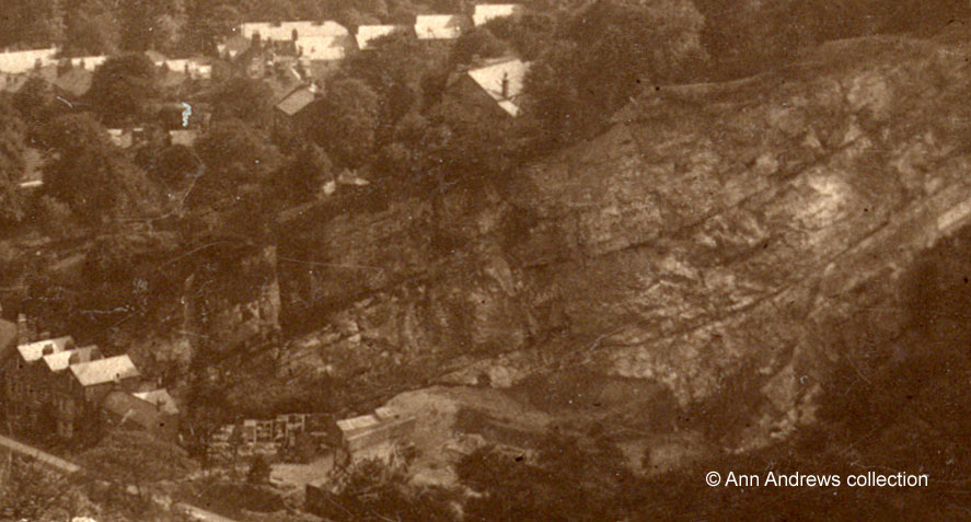
Long Tor was a working quarry when this picture was taken. At blasting time spectators would gather at the quarry entrance, although it is unclear, in the newspaper article below, whether they watched the whole thing or arrived once the huge chunks of stone were safely down.
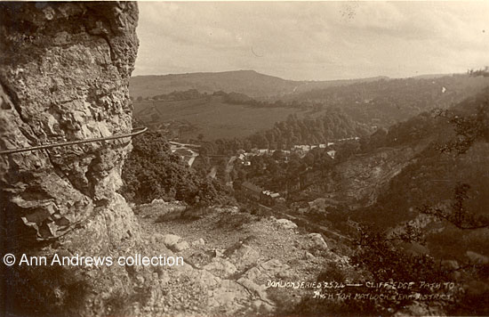
Unfortunately, as well as giving pleasure to climbers and visitors, the Tor has seen a number of accidents of varying severity over the years. For example, in June 1911 two female visitors to Matlock Bath had what was later described as an alarming experience when "they narrowly avoided being dashed to pieces on the High Tor". They arrived at the station early one morning, hoping to climb to the summit. Probably because of the time of day they had chosen, there was nobody around to help them. They chose an old footpath used by lead miners instead of the normal route. This track was afterwards described as treacherous and full of stones, on a part of "the hill that is almost perpendicular". They persisted with their walk and eventually arrived at an extremely steep downwards slope. It was here they realised they were in in an extremely difficult situation and, seemingly, panicked. One of the the pair slipped down about 20 feet before her fall was broken by a wall close to the ventilation hole in the High Tor Tunnel, which had been built to stop stones falling onto the track. The other woman lay down and began to scream for help until Midland Railway staff came to the rescue. One man climbed out of the tunnel to assist the woman who had fallen; she was apparently lowered into the tunnel and then taken to safety. The second woman was helped retrace her steps and the two were re-united[2]. The top postcard shows that the station is some distance from even the base of High Tor and the two women had gone past this point to end up where they did. A closer look at this footpath itself shows both bare rock and gravel; the gravel would be slippery and the rock was lethal as there were jagged points that anyone could trip over, even with suitable footwear. In September the same year a 13 year old boy, who had arrived with a party of 500 from the Co-operative Boot Company of Rushden, ascended the Tor with his friends. He was not with them all the time and had the misfortune to have fallen asleep whilst reading. He apparently rolled down the slope and was unconscious when he was eventually found. Apart from the shock, he had some kind of neck injury but was well enough to return home[3]. So these three people seem to have had lucky escapes. Not everyone did. |
|||||||||||||||||
|
|||||||||||||||||
|
|
|||||||||||||||||
1. "Cliff Edge Path to High Tor, Matlock, Peak District". Donlion Productions, Doncaster, No.25.24. British Manufacture. Copyright Real Photograph. Not posted. 2. "Switzerland View High Tor, Matlock, Peak District". Donlion Productions, Doncaster, No. 25:28. British Manufacture. Unused. Postcards in the collection of, provided by and © Ann Andrews. Information researched, written by and © Ann Andrews. Intended for personal use only. |
|||||||||||||||||
References (coloured links are to transcripts or more information elsewhere on this web site): [1] "Sheffield Daily Telegraph", 4 February 1922. Death of Thomas Bridge (53), a well known limestone quarry owner at the Long Tor. [2] "Derbyshire Courier", 10 June 1911 and "Belper News" 16 June 1911. Ladies Terrible Plight. [3] "Derbyshire Advertiser and
Journal", 8 September 1911. |
|||||||||||||||||


