|
Images Index> Matlock, 20th and 21stC Images> This page |
| Matlock from Riber, 1914 |
| Matlock: Twentieth Century Photographs, Postcards, Engravings & Etchings |
|
|
|||||||||||||
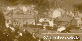
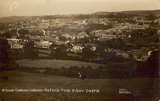
When the image is enlarged a horse can be seen tethered at the bend in Church Street and a horse and cart are wending their way up Lime Tree Road (both are just about visible in the image immediately below). There are several people in the photograph, though they are too small to be seen in the picture here. Two figures are on the Tansley side of the Horse Shoe in Matlock Green, for example, and there's even a couple sitting behind a hedge! Look almost vertically above the 7 of the card's number. In the field next to the one with the card's number in it, close to the hedge, is a white dot. The white is a shirt or blouse.
On the far side of Dean Hill House are two large fields known as the Dean Fields which extend down the hill from Chesterfield Road to the edge of the football ground. The first newspaper reference to these fields occurred in 1811 with a sale at the Horse Shoe Inn at Matlock Green. Lot 3 was Nether Dean Hills (3a. 2r. 15p.) with barn and a carpenter's shop on the lower end; it was then occupied by William Ellis. Lot 4 was a freehold close known as Upper Dean Hills (3a. 2r. 16p.) also occupied by William Ellis[3]. Thirty one years later, in 1842, Charles Else advertised for sale, amongst other properties, "Lot 4. Freehold. A valuable piece or parcel of land, with the barn thereon standing, called Deans Hills, in the occupation of William Ellis"[4].
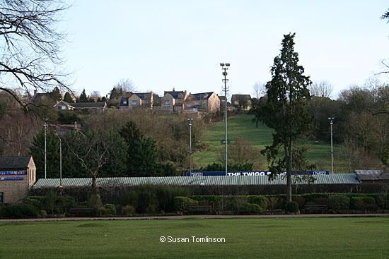
 The Dean Fields are called the Dene Fields these days[6]. This photo of the land was taken from Hall Leys Park in February 2016. Matlock's football ground is on the far side of Causeway Lane. The field boundaries shown on the 1848 tithe map and on the images above are still clearly defined today. |
||||||||||||||
1, 2, 3. "Matlock from Riber". Published by Valentine's X. L. Series Real Photo Regd, no. 79652. Printed in Great Britain. Unposted, but postcard registered in 1914. Message, written in 1927, not relevant to card. In the collection of, provided by and © Ann Andrews. 4." Matlock from Riber Castle".. Published by Hawley, Matlock, No.42GS. No date. © Susan Tomlinson collection. 5. 2016 photograph kindly taken for this website by and © Susan Tomlinson. Information researched, written by and © Ann Andrews. Intended for personal use only. |
||||||||||||||
References (coloured links are to transcripts and information elsewhere on this web site): [1] There are a number of references to the Harrisons: [2] Thomas Stevens appears in White's 1862 Directory | Matlock Green Congregational Church, Roll of Church Members, 1866 - 1919 [3] "Derby Mercury", 24 October 1811. [4] "Derby Mercury", 2 March 1842. [5] "Derbyshire Times", 20 May 1933. New grounds for Matlock. Council Purchase Dean Hills. [6] It is not clear when the spelling
of Dean Fields was changed by the Council. Dean Hill House was
still shown on the OS map of 1967, so it is assumed that it was
some time after that. A family called Deane lived in Matlock in the sixteenth century. See details
of the 1544
Will of Robert DEANE and arms
of DEANE. |


